Toronto Islands
This post continues my efforts to document pre-automobile places. We learn better design from understanding how communities were created before streets were given over to cars.
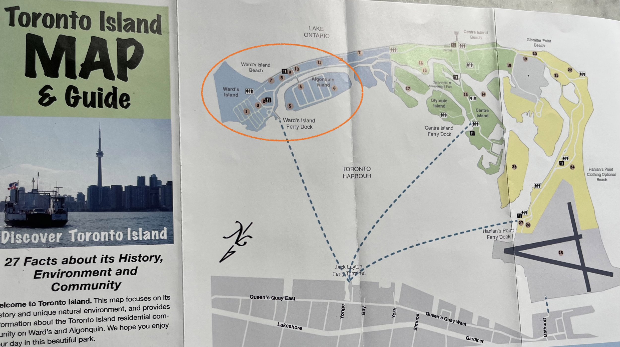
Toronto Island Map and Guide. The blue islands (circled in orange) are the residential neighborhoods. Wards Island is on the far left. Algonquin Island is to the right of the circle. The green and yellow bits of the islands are amusement parks and beaches. The airport is on the right.
The Toronto Islands are an archipelago of sandbars jutting into Lake Ontario from Toronto. They are sacred to the Mississaugas of the Credit. They were created via erosion from the Scarborough Bluffs, then separated from the mainland during in violent storm in 1858. Today they are home to residential communities, an amusement park, a nude beach, and YTZ airport.
Yes, you can see the nude beach when landing at YTZ.
My interest is the residential communities on Wards and Algonquin Islands. Their development pre-dated or occurred in the absence of cars - only service and delivery vehicles are allowed - so it provides a natural experiment on how a community is configured sans cars. The residential areas on Wards Island are the outgrowth of camps established by seasonal fishermen. Eventually they were joined by entire families in tent cities. Beginning in 1931 cottages were built. Cottages began to appear on Algonquin Island in 1938. Most were constructed elsewhere and floated in. The island was surveyed and divided into the lots and blocks in the 1940s. WWII veterans leased lots and built cottages.
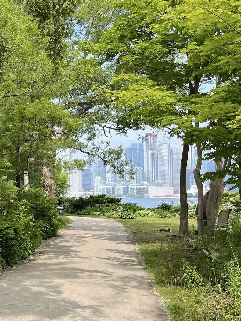
View of Toronto skyline from Wards Island
There are two sections with homes on Wards Island. The northern portion has eight blocks. They average about 40m by 130m (132’ x 427’). 40m is about a 30 second walk. The layout is fairly organic, with only Third Street being straight and continuous. The southern portion has one block, which is about 65m by 130m (213’ x 427’). The lots are of varying sizes, but seem to be about 12m x 18m (40’ x 60’).
The five blocks on Algonquin are larger than those on Wards. The width spacing is 80m (264’). 80m is about a 1 minute walk and a common block spacing. The lengths are largely defined by the size of the island, but is around 200m, which is 1/8 of a mile. The lots are uniformly 15m x 30m (50’ x 100’).
The most non-auto-centric element of the communities are the streets, which are really paths. On Wards they are 2.1m - 3.0m wide (7-10’) in a 4.0m ROW (13’). On Algonquin they are 3.0m - 3.6m wide (10-12’) in a 20m ROW (66’). The former are decidedly more intimate; the latter more gracious. Of particular note are the curved corners. People do not generally turn corners like they are marching, so why design sidewalks and paths like they do. Also, curves better accommodate people on bikes.
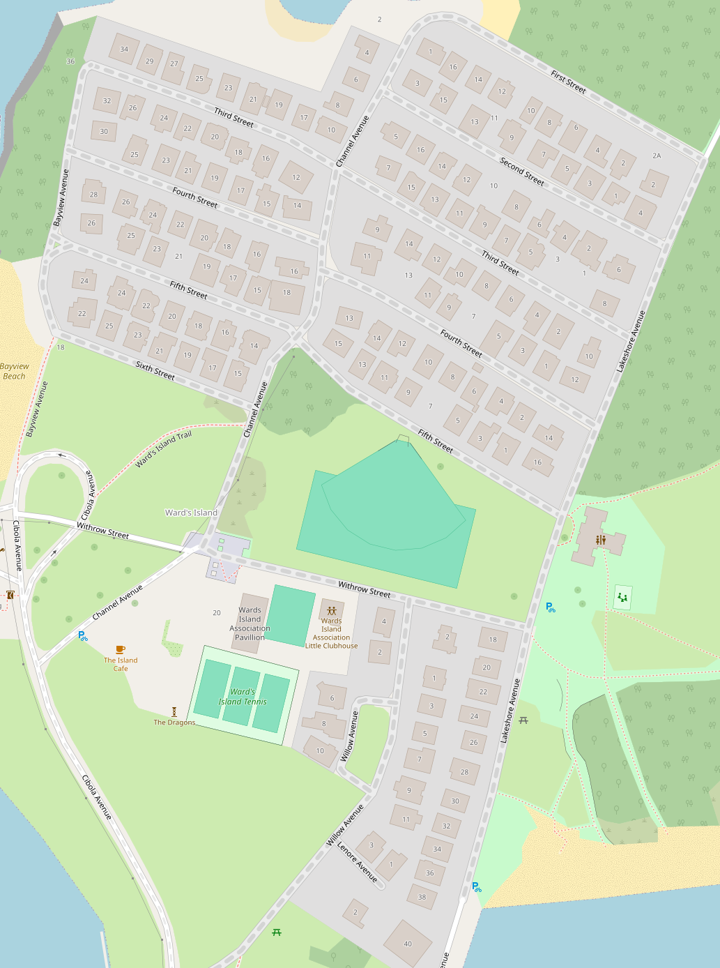
Residential communities on Wards Island, Open Street Map
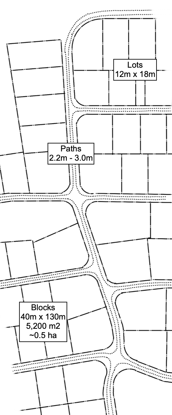
The block, lot, and path layout on Wards Island.
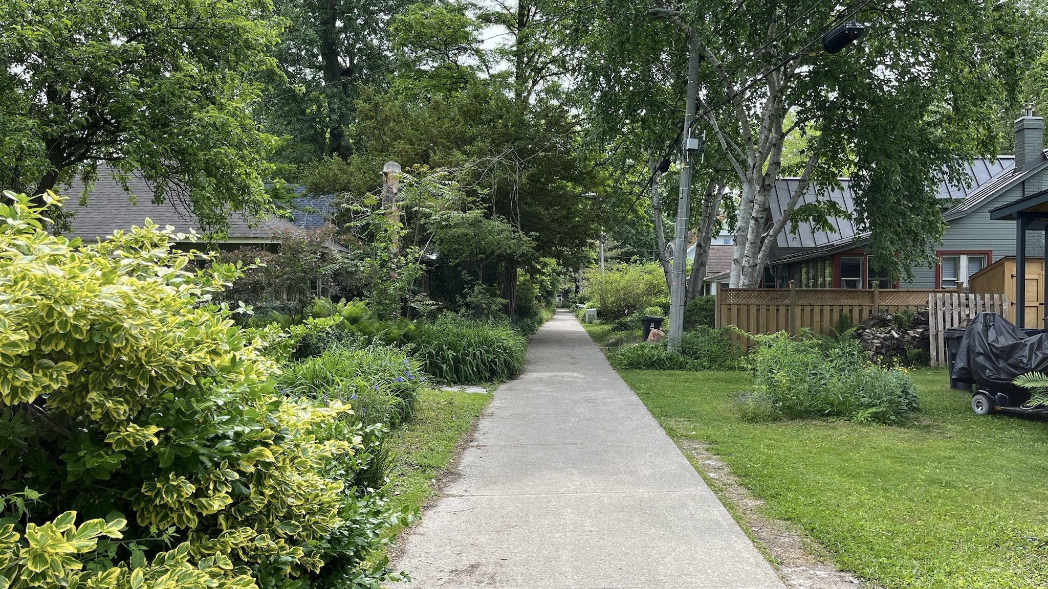
Typical intimate path on Wards Island
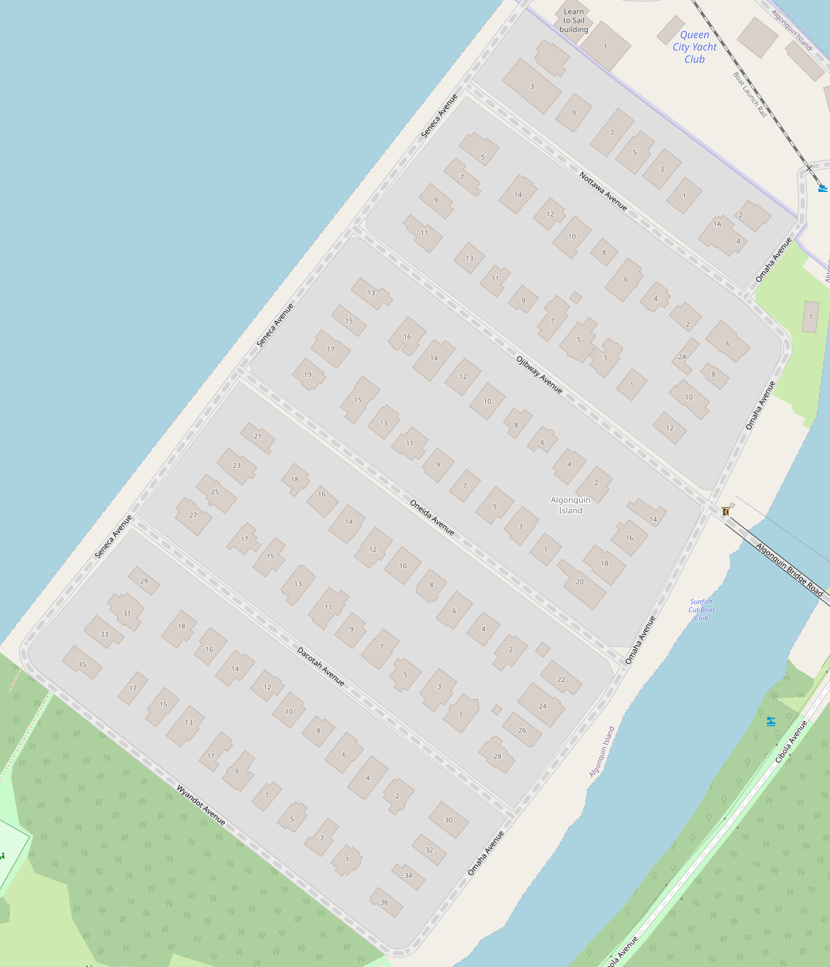
Algonquin Island, Open Street Map
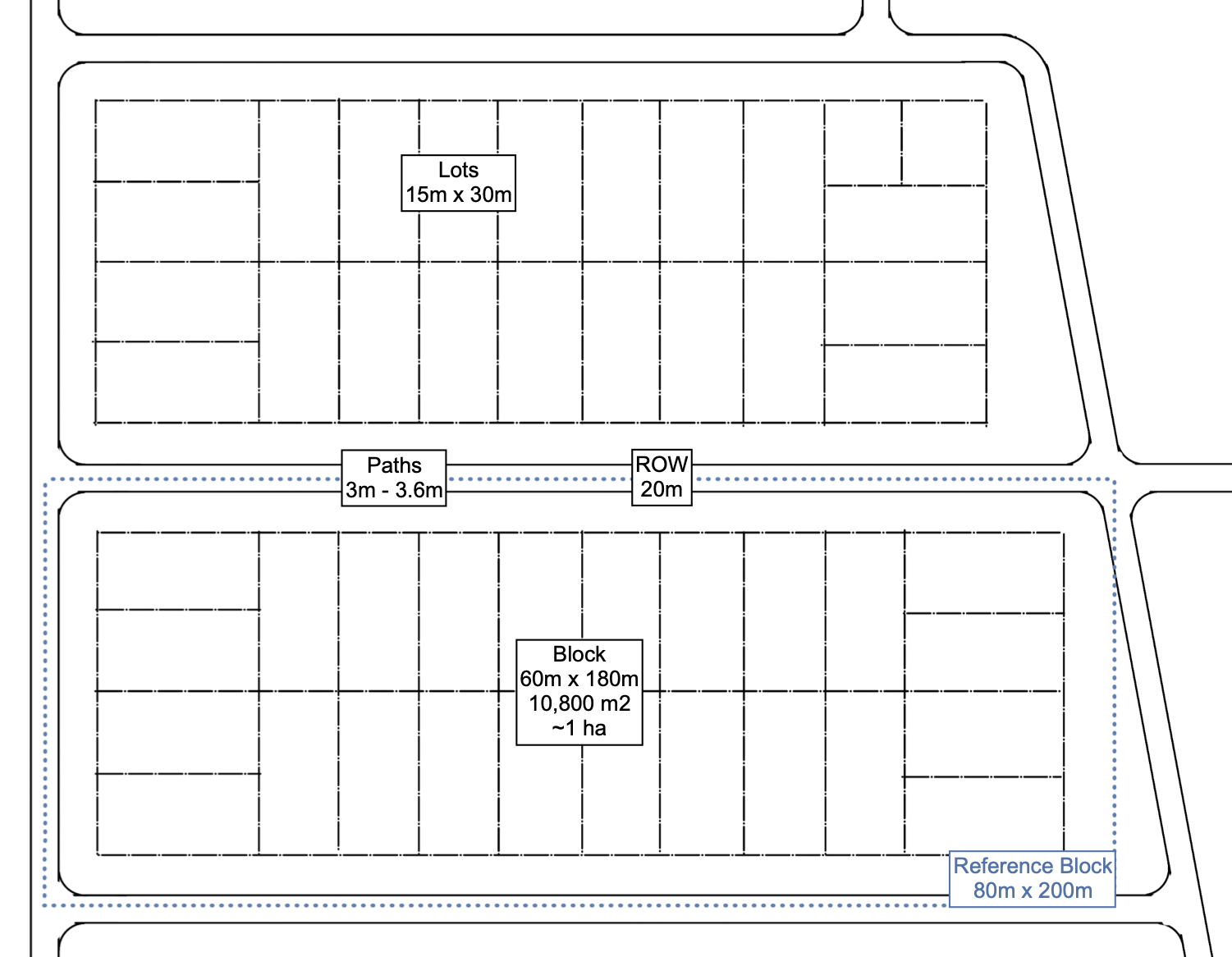
The block, lot, and path layout on Algonquin Island.

Relationship between paths, yards, and homes on Algonquin Island
Takeaways
The paths, lots, and blocks on Wards Island are illustrative of a pedestrian-oriented community. It is intimate and walking-scale. It clearly developed organically.
The lots and blocks on Algonquin Island are more standardized, and the paths are wider and straighter. Yet the lack of wide, curbed streets and driveways illustrate how one can have an auto-free neighborhood within a standard structure.
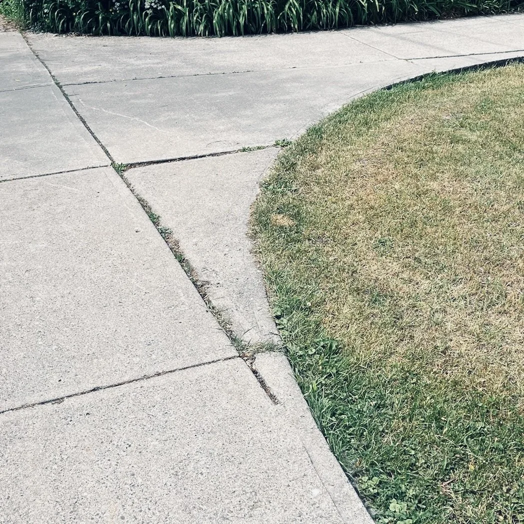
Path intersections are rounded; cyclists can turn easily. A simple design feature that should be replicated!
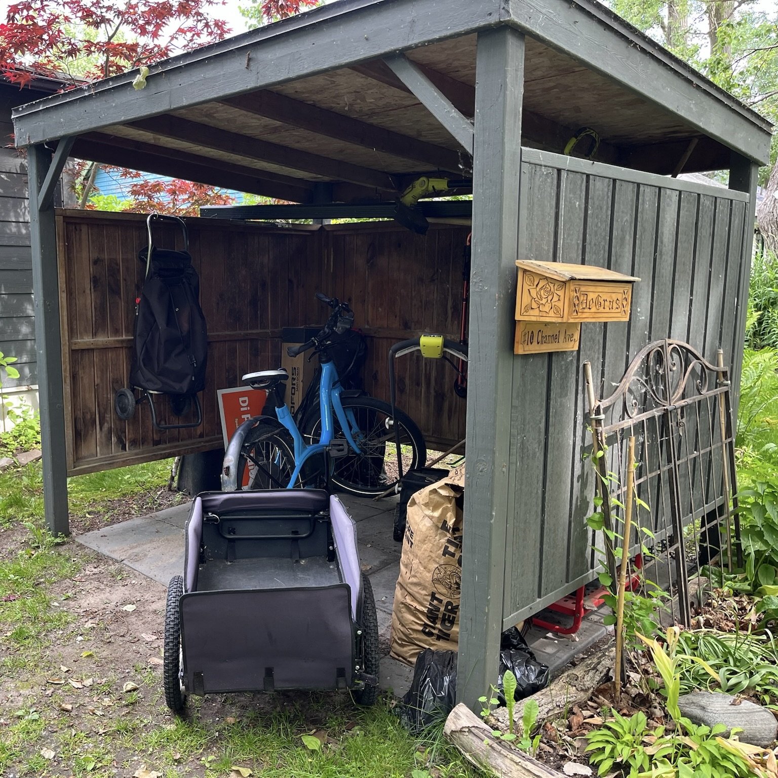
The main mode of transport
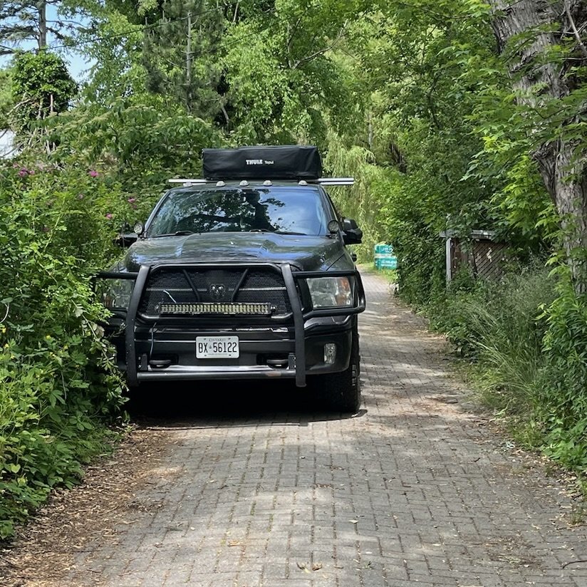
Service vehicles are allowed.
Read more
https://torontoisland.org, https://www.algonquinislandassociation.ca/aia-history, https://historyoftoronto.ca/blog/the-fascinating-and-rich-history-of-toronto-island-revealed-from-indigenous-settlers-to-amusement-parks-and-heritage-conservation-efforts, https://www.thecanadianencyclopedia.ca/en/article/toronto-islands, https://www.torontojourney416.com/toronto-island/, https://oldtomaps.blogspot.com/2013/08/toronto-island.html, https://spacing.ca/toronto/2015/01/28/exploring-downtown-centreville-winter-ghost-town-ways-one/.