Thousand Island Park
Walkable urbanism is often the goal of city planners and urban designers. We strive to create places where people can live, work and play as a community, not commuter. Currently, the 15-minute city is being heralded as the answer to the post-pandemic puzzle.
This blog documents a summer resort community in New York known as Thousand Island Park. It was founded 145 years ago, before the onslaught of the automobile, and has largely been able to evade motordom’s makeover. In addition to being a delightful way to summer, it is also an ideal locale to explore the street grid and street design details that inspire city makeovers.

The greensward, Wellesley Avenue and marina of TI Park. Courtesy 1000islandparkrentals.com.
Context
Thousand Island Park (TI Park) is a summer resort community on Wellesley Island in the Thousand Island region of New York. Founded in 1875 as a tent revival camp associated with the Methodist Church, it became known as the Chautauqua of the North. It is bordered on three sides by water and one side by the hilly, forested Wellesley Island State Park. There is one road (Route 100) connecting the hamlet to the rest of the island. There are approximately 325 houses and the historic district is listed on the National Register of Historic Places. The center of town has a library, small hotel, restaurants, shops, offices, post office, church, meeting hall, ball fields/courts, playgrounds, and marina - just enough amenities not to have to drive out of the park everyday.
TI Park was founded when people mostly walked everywhere. The walk across town is about 15 minutes (.75 mile / 1.2 km). Located on an island, the only access for the first 63 years was by ferry. In 1938 bridges (now Interstate 81) were constructed connecting Wellesley Island to the mainlands of New York and Ontario. This altered access to and the nature of the park and led to the eventual discontinuation of ferry service. Even with easy car access now, it remains a bucolic community. As another blog observes, “Few cars and absence of through traffic make [TI Park] kid-friendly.”
TI Park is a 15 minute town.

Commercial building at town center with veranda, outdoor seating, balcony, trees, and bicycle parking. Note area between building and street is NOT filled with parking.
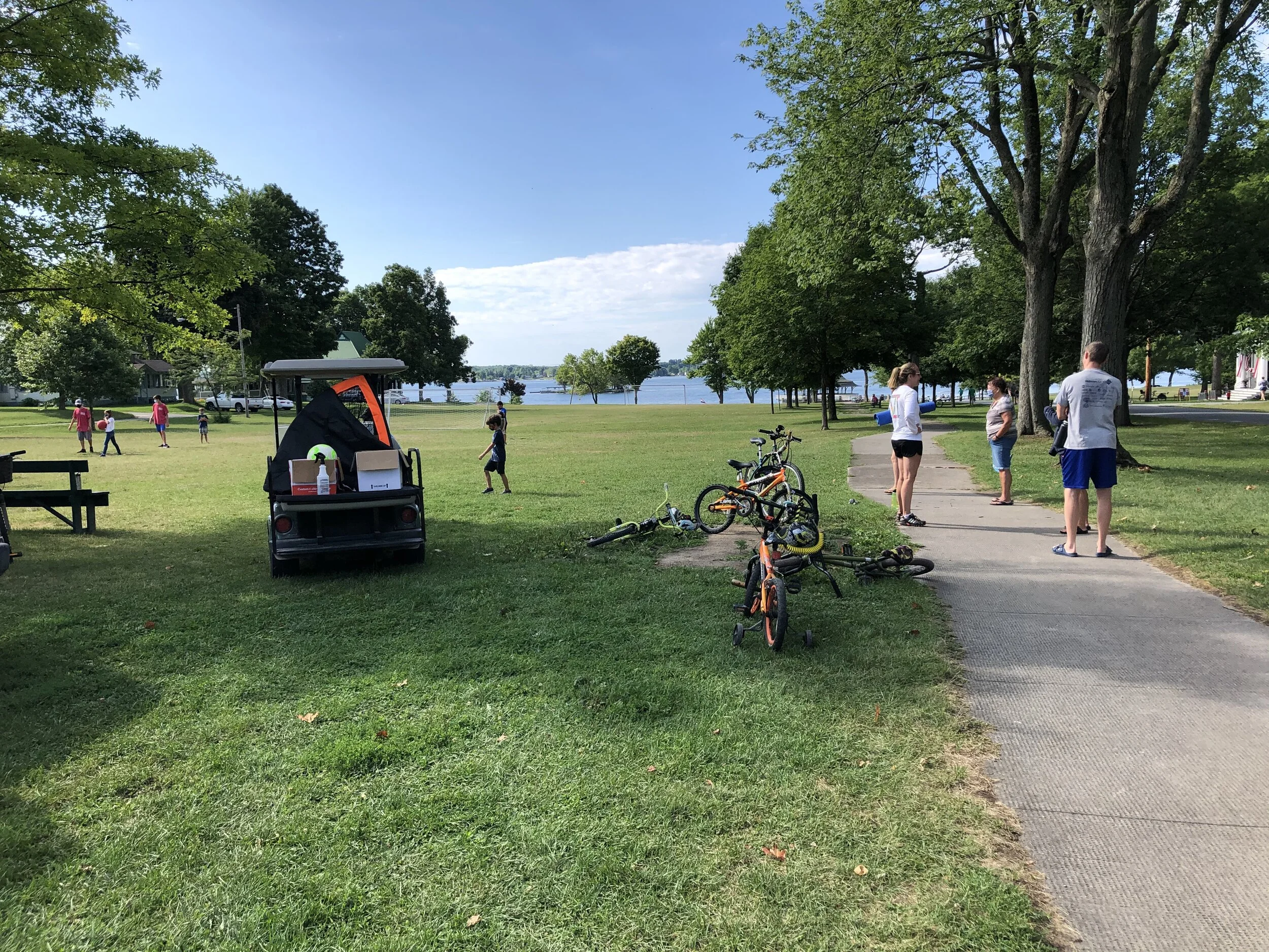
Town green with the daily children’s activities. St Lawrence Avenue and library are to the right. Marina is at waterfront.
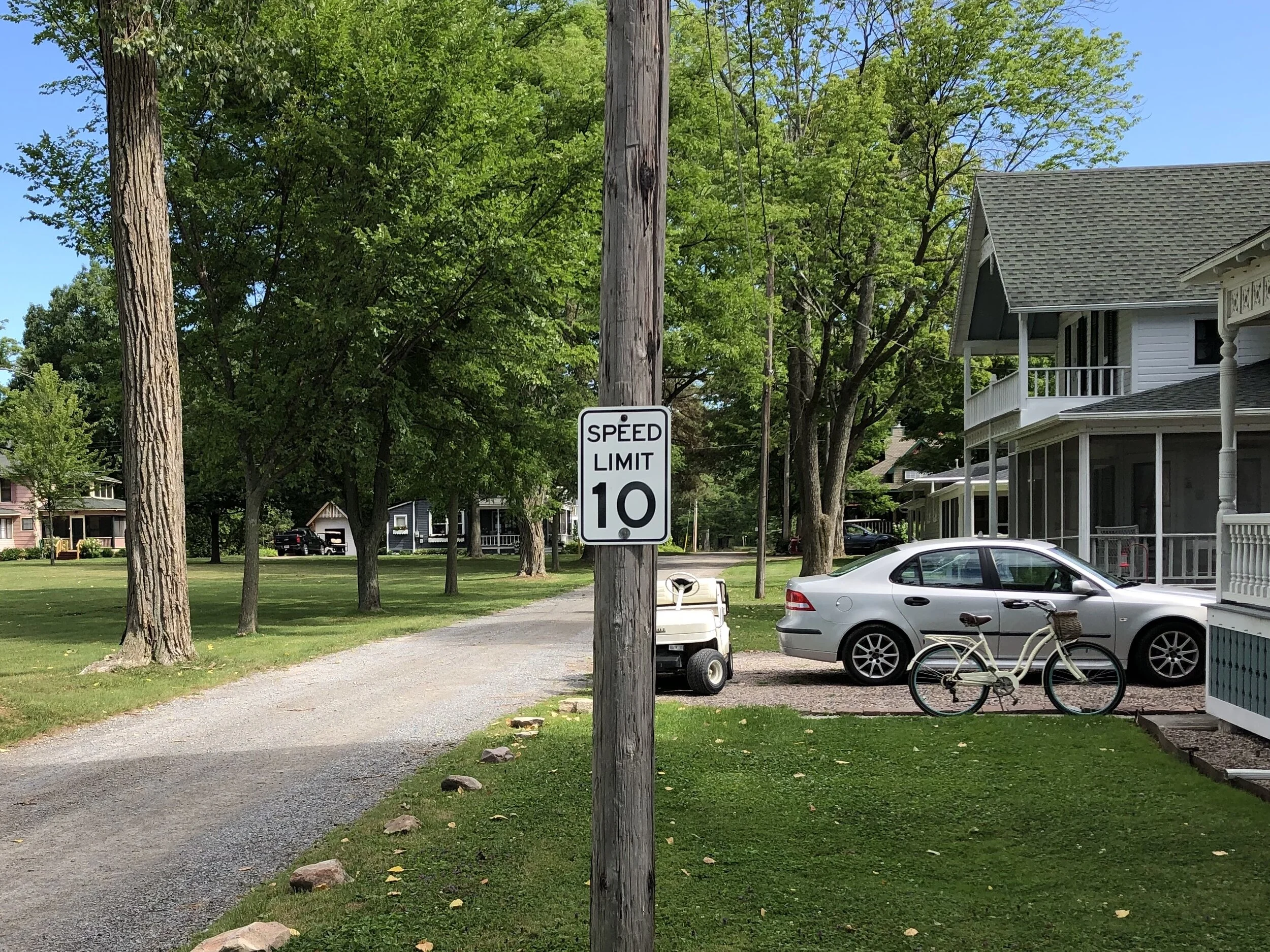
Typical interior street. Unpaved, rocks as curbs, 10 mph speed limit, no sidewalk.

Garden Avenue with just the sidewalk. This is where the paved street would have been. Two blocks in the distance it is paved.
Street grid
Street grids are the underlying foundation of cities. Cities rise and fall within the framework of their grids. Grids set the tempo for mobility/circulation, regeneration/redevelopment, context, and built form. If the street grid sets the stage, then the street details direct the performance.
The land area of TI Park is a mostly flat 0.3 m2 (0.75 km2). There are about 50 blocks of regular and irregular shapes, but mostly rectangles. There are about 390 intersections per square mile (156 per km2) which slots it between Zurich, downtown Portland, and Paris near the Louvre. The streets (Avenues) leading away from the water generally are spaced 200-210 ft apart. The cross-streets (Streets) range from 260 to 540 ft apart. There is a kink in the grid that follows the shoreline. This creates a series of triangular blocks just to the west of the center of town.
This block spacing is the ideal one-minute walk.

St Lawrence Avenue is the formal center of TI Park. Romans would call it the Cardo. Parisians would call it a promenade. It has the widest right-of-way, bisects the commercial center, and connects the Tabernacle (the religious revival center) to the Marina (where the ferries landed). About 1450 ft (440 m) long, it is a six minute walk end to end. The Tabernacle terminates the northern vista, while the view to the south is of the river. The lower half of St Lawrence Avenue slices through a 7.5 ac (3 ha) greensward. The library, playground and ball fields are here, as was the old hotel. This is TI Parks central gathering place with shops to the north, the river to the south, and plenty of room for dogs to chase frisbees.
St Lawrence Ave is two armatures long, an ideal length in urban design.
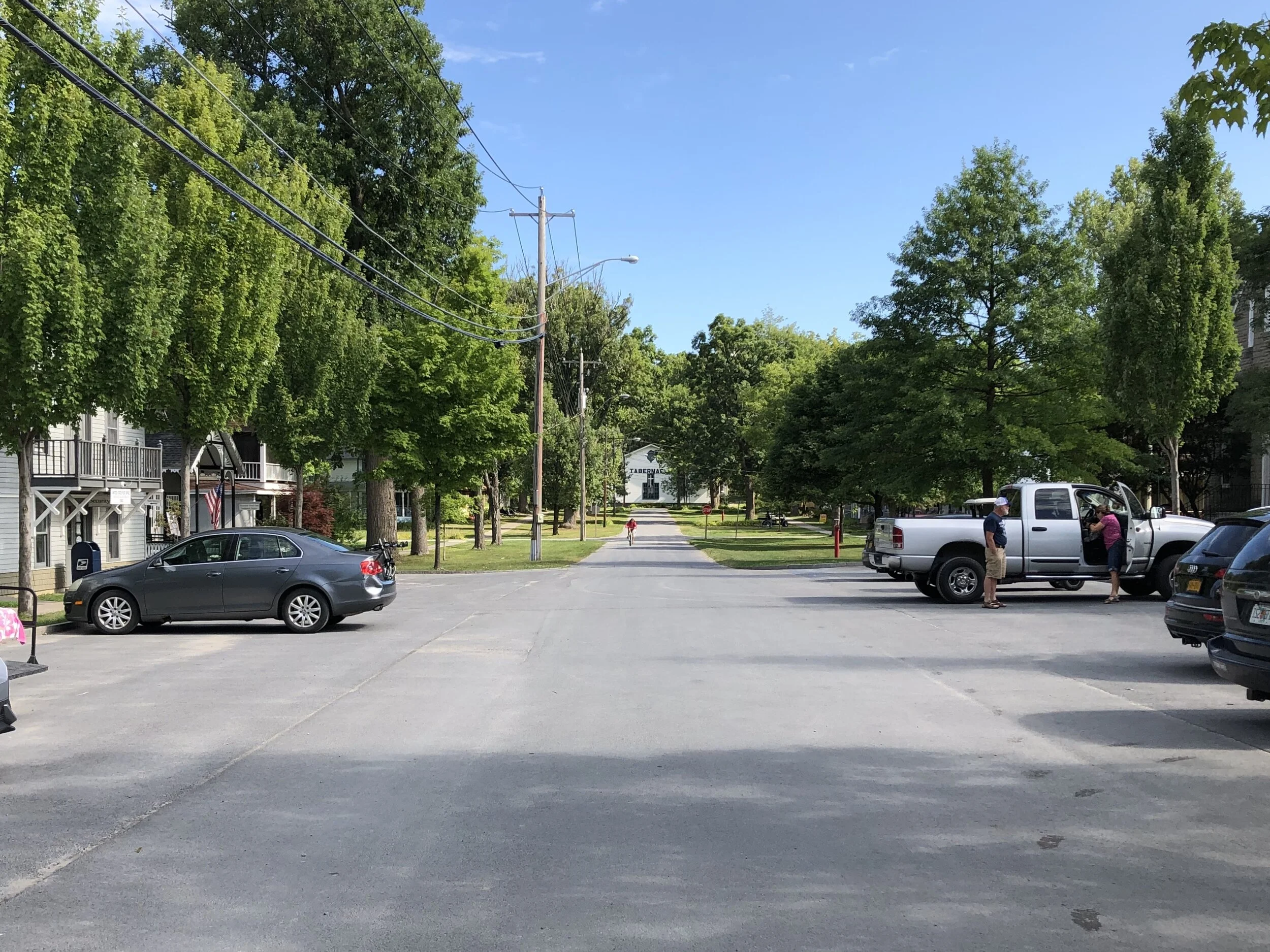
Rainbow Street traverses the hamlet and funnels vehicles into and out of town. It would be the Decumanus in Roman parlance. There is nothing extraordinary about the street in the original platting, so I assume it received its importance after the bridge was built. Nevertheless, only its paving and speed limit (15 mph) set it apart from the other streets. About 2450 ft (750 m) long end to end, it is a 10-minute walk.
Other streets of import are Coast Avenue, which hugs the shoreline, and the curvilinear streets emanating from the Tabernacle. Interestingly, Coast Avenue is discontinuous, presumably to minimize through traffic.
St Lawrence Avenue, the main north-south street. 100’/30m right-of-way with 20’/6m pavement (20% of ROW). No curbs. No markings. Parking has been added near the shops. The Tabernacle terminates the vista.

Walkway of St Lawrence Avenue passing through the greensward and an allee of trees.

Rainbow Street, the main east-west corridor. 18’/5.5m wide pavement. No curbs.
Street details
Largely gravel, the streets of TI Park are unpaved, uncurbed, and unfussy. Some “streets” are actually bike paths, and some streets simply do not exist (although the space is reserved). There are few curbs to speak of. Catch basins for the stormwater sewer system are located as per topography. Some streets have sidewalks on one side. Wonderfully, these extend across the roadway in numerous places to form mini raised crosswalks. 10 mph is the general speed limit, with 15 mph on the route in and out of town.
Parking (other than at one’s house) is quite limited. There are a few spaces in the town center and near the boat launches along Bay Shore Road. There is no parking at the marina, the town beach, and other destinations. As a consequence, nothing is dominated by massive expanses of asphalt. Bicycles and scooters are used by most, especially the youth. Electric golf carts are available to rent for $40 per year. These allow people, especially those with limited mobility, to move around town.
Trees abound in TI Park, shading the streets and walkways, and organically slowing drivers. The lack of curbs, curb cuts, and parking, coupled with lawns and stupendous gardens accentuate the primacy of green mobility. Houses (and their front porches) are set near the street so there is constant social interaction while walking.

People cross streets according to their desire line, in this case diagonally. Don’t tell the traffic police!

People walking freely in the street - the horror. There are too many to fit onto sidewalk. Sidewalk is 4’/1.2m wide, which is marginally accessible.

Walkways continue across the street, as they should.

Walkway extending across street as crosswalk. Raised maybe one or two inches, no markings, stop sign, aligned directly with walkway.

Large truck making deliveries on narrow street. Yes, it can be done - despite the protestations of your local traffic consultant.

Bike path crossing of street. Drivers, not cyclists, have the stop sign. This is how it should be since cyclists are the more vulnerable users. The smaller white sign states golf carts are not allowed on the bike path.
Lessons
TI Park works as a walking community largely because it has not given cars primacy. Vehicle remains low and speeds slow. While most arrive by car, they largely remain parked while people walk, cycle or use golf carts. The hamlet sits at the end of the island, so there is no through traffic. There is also a “no leash law”, so even dogs have the right of way over drivers!